Open Data Week: Mapping colocated schools in NYC
Published March 7, 2025 EventsMatt Curinga and Liz de Freitas along with student researchers Gabriella Deninno, Akbota Zhumabaikyzy, and Claire Filipek. Present their work at NYC Open Data Week 2025.
Colocated schools are not unique to New York City, but they are very much a part of daily life of NYC schools. More than 70% of high schools and the majority of students in grades 9-12 attend a colocated school. We will discuss some of the recent history of the small schools and charter movement that has increased colocations in NYC; as well as our theoretical grounding in spatial justice, critical cartography, and the politics of aesthetics and digital media.
For this talk, we use our open source nycschools python
library to access the most recent NYCPS Demographic Snapshot,
combined with the NYC Open Data school location record to identify
which schools share a location. This avoids relying on Department
of Buildings records or trying to match schools by address.
We run statistical analysis to determine that colocated schools are more likely to have higher percentages of Black, Latine students; and higher rates of students living in poverty.
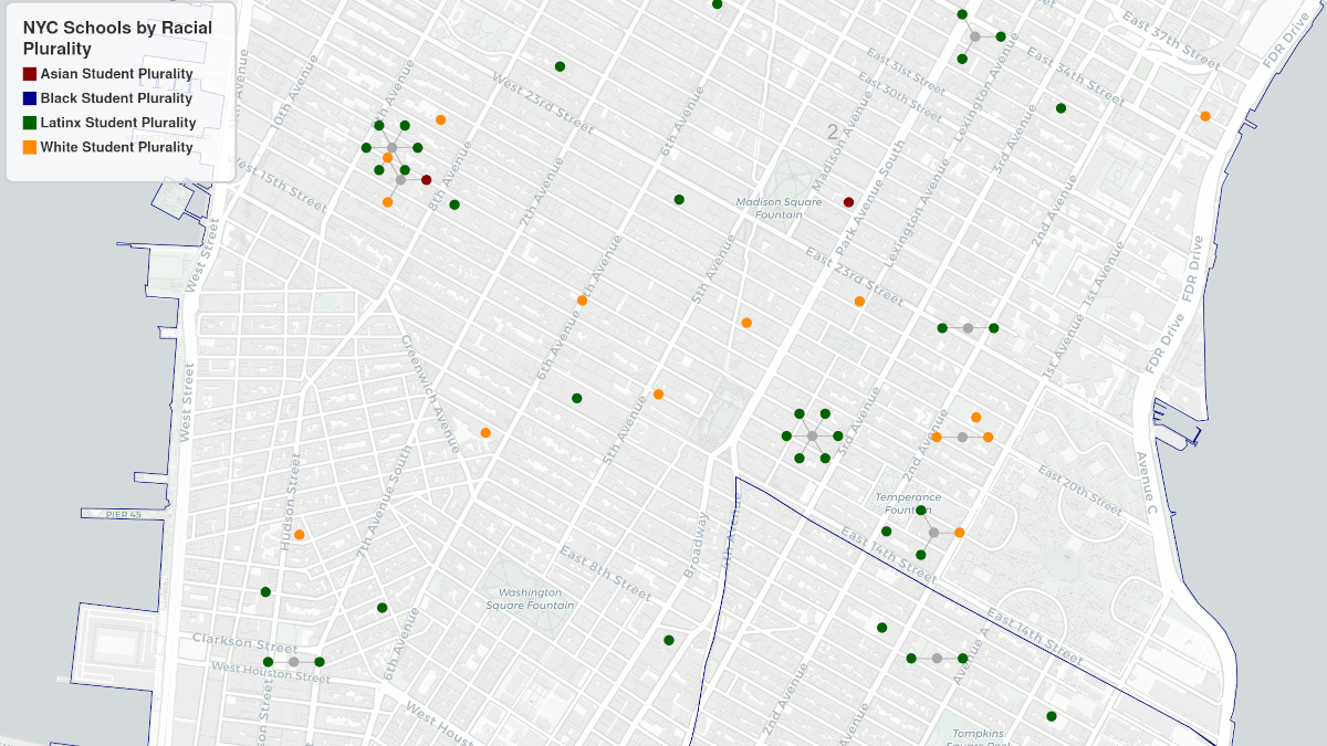
We also discuss some of the challenges of visualizing geospatial data where multiple data points share the same location. To address this concern, we demonstrate a technique using radial clusters around central campus points that allow both an overview of the data as well as the ability to zoom to each data point. We end our talk with optional workshops where you can get help getting started programming Python with school and Census data.
Event Details
Resources
- Open Data Week Presentation
- Event Page
- Slides
- [Recording] (TBD)
nycschoolsfree open source software python library [code] [docs]maptoolsfree open source software python library [code]- Colocation Data & Charts [Colab Notebook]
- Colocation Plurality [Map] [Colab Notebook]
- Census and other Maps [Maps] [Colab Notebook]