Mapping open school and census data in New York City
Published March 28, 2024 News
maps
python
foss
school buildings
census
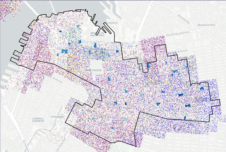
MIXI researcher Matt Curinga and graduate researcher Jacob Geier presented at NYC Open Data Week 2024. They shared their recent work, in collaboration Liz de Freitas, exploring New York City schools, with a focus on school and City demographics at the level of school buildings and neighborhoods. Free Open Source Software python library, “nycschools”, which makes it easier to work with and analyze open data regarding New York City Public Schools, including geospatial data.
Video of the talk coming soon, on the BetaNYC YouTube page.
Resources
Python code examples from talk:
- School & District Map (basic map template)
- Static Map Series (district demographics)
- Interactive Schools (data-driven interactive school maps)
- NYC Census (combining school and census data)
- School Locations (where and when were the schools built)
- Schools & Census (dot density census map with school data)